 Ship Inspection
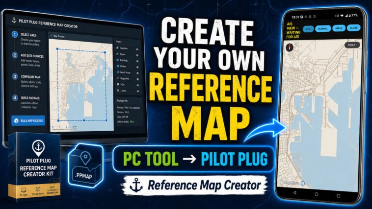
Need an offline map for your own port, river, coast, anchorage, or operating area? Now you can create one yourself.
With the free Pilot Plug Reference Map Creator v1.0.0, Pilot Plug users can create their own offline geographic reference maps on a Windows PC and import them directly into the Pilot Plug Android app.
You are no longer limited to the downloadable reference maps that we publish.
If you operate somewhere for which Pilot Plug does not yet provide a map, you can simply create a map for the area you actually need.
Any Area – According to Your Needs
Every mariner works in a different environment.
One pilot may need a detailed background around a single harbour. Another may want an entire coastal approach. A yacht user might need an island group, while another user may want a reference map covering a river or a remote part of the world where internet access is unreliable.
The Reference Map Creator lets you define the geographic area yourself.
For example, you could create an offline reference map for:
- your home port and its approaches;
- a pilotage or harbour operating area;
- a section of coastline;
- a river or canal;
- an island or group of islands;
- an anchorage or offshore operating area;
- an entire region, where practical.
You simply define a rectangular geographic area using its west, south, east and north coordinates.
The Creator then automatically selects an appropriate Geofabrik/OpenStreetMap source, builds the map, validates it and packages the result into a .ppmap file.
No QGIS or Python Required
The Reference Map Creator was designed specifically to make this process accessible to users who are not GIS specialists.
You do not need QGIS.
You do not need Python.
The Creator runs on Windows using PowerShell, and the required Java 21 and Planetiler environment is downloaded and verified automatically during setup.
Once the initial setup has passed, creating another geographic reference map is mainly a matter of defining the area and allowing the Creator to do the processing.
From PC to Pilot Plug
The complete workflow is:
Choose an area → Create the map → Copy the .ppmap to Android → MAPS → IMPORT → Use it offline.
Once imported, the reference map is stored locally on the Android device.
That means the geographic background can continue to work without an internet connection.
This can be particularly useful aboard ships, around ports, offshore, or anywhere mobile data coverage is poor or unavailable.
Build Small Maps or Large Maps
You decide how much territory the map should cover.
A small harbour map will normally be faster to create and produce a smaller file. A large regional map requires considerably more source data, processing time, storage and memory.
So bigger is not necessarily better.
For operational use, it often makes more sense to create a map specifically around the area where you actually work.
For example, instead of building a map for an entire country, a pilot could create one covering the port, pilot boarding area and approaches.
That is one of the main reasons we created this tool: the user decides what geographic coverage is useful.
Detailed Offline Geographic Background
The current Reference Map Creator uses the Pilot Plug DETAILED v1 reference-map profile and can render geographic reference information up to zoom 14.
Depending on the available OpenStreetMap source data, this can provide useful background information including land and water geography, place information and transportation features.
However, there is an important distinction:
Pilot Plug Reference Maps are not nautical charts.
They are intended for situational awareness and general geographic reference.
They do not replace official nautical charts, ECDIS, approved navigation equipment, bridge procedures, visual lookout or professional judgement.
Reference Maps vs. User Maps
Pilot Plug now provides two different ways of creating your own offline mapping content.
Reference Map Creator is the simple option when you want to create the geographic background map for an area.
The more advanced Pilot Plug User Map Authoring Kit uses QGIS and allows users to create their own operational overlays and objects, including marks, waypoints, berths, pilot boarding positions, leading lines, recommended tracks, anchorages, restricted areas, caution areas and other supported Pilot Plug objects.
The two systems therefore have different purposes:
Reference Map Creator = create the geographic background.
User Map Authoring Kit = create your own operational information and objects.
For advanced users, this opens an interesting possibility: create an offline reference map for the required geographic area and then create your own operational User Map according to the way you work.
Free Tools for the Pilot Plug Community
The Reference Map Creator is provided as a free PC tool.
Our goal is not to decide which parts of the world Pilot Plug users are allowed to have offline.
We will continue providing downloadable reference maps for selected regions, but it is impossible for us to anticipate every port and operating area used by pilots, captains, officers and other mariners around the world.
Giving users the tools to create their own maps solves that problem.
If the map you need does not exist, create it.
You choose the area.
Pilot Plug Reference Map Creator builds it.
And after importing the resulting .ppmap, you can take that geographic reference map with you offline.
Watch the Video Tutorial
How to Create an Offline Reference Map for Pilot Plug
The new video tutorial demonstrates the complete process-from setting up the Creator on Windows and defining your geographic area to building the .ppmap file and importing it into Pilot Plug.