 Ship Inspection
Marine Navigation by XShipX – Offline Marine Navigation, Public AIS and a Shared .ppmap Map Ecosystem
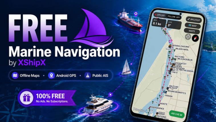
Marine Navigation by XShipX has received a major update, bringing together offline marine maps, Android GPS navigation and public AIS vessel information in a single straightforward application for boats, coastal navigation and port environments.
The objective is simple: provide a practical navigation application that works primarily from locally stored maps and the Android device’s own GPS, without making normal navigation dependent on a permanent internet connection.
Once a map has been installed, Marine Navigation can continue displaying the vessel’s position, course, speed and navigation information even when internet connectivity is unavailable.
Offline Navigation at the Core
Marine Navigation is built around the .ppmap offline map format.
Maps can be downloaded directly through the application’s ONLINE MAPS catalog or imported manually from the device.
After installation, the map is stored locally and can be used without an internet connection.
This is particularly useful for marine environments where mobile coverage may be unreliable, expensive or completely unavailable.
The application uses the Android device’s internal GPS to provide:
- Vessel position
- Speed Over Ground – SOG
- Course Over Ground – COG
- FOLLOW mode
- Map rotation
- Recentering
- Bearing and distance measurement
- Measure and Time-To-Go tools
The intention is not to turn an Android device into certified bridge equipment, but to provide a practical and accessible navigation reference for boat owners, coastal users and operators working around ports and harbours.
One Map Format for Marine Navigation and Pilot Plug
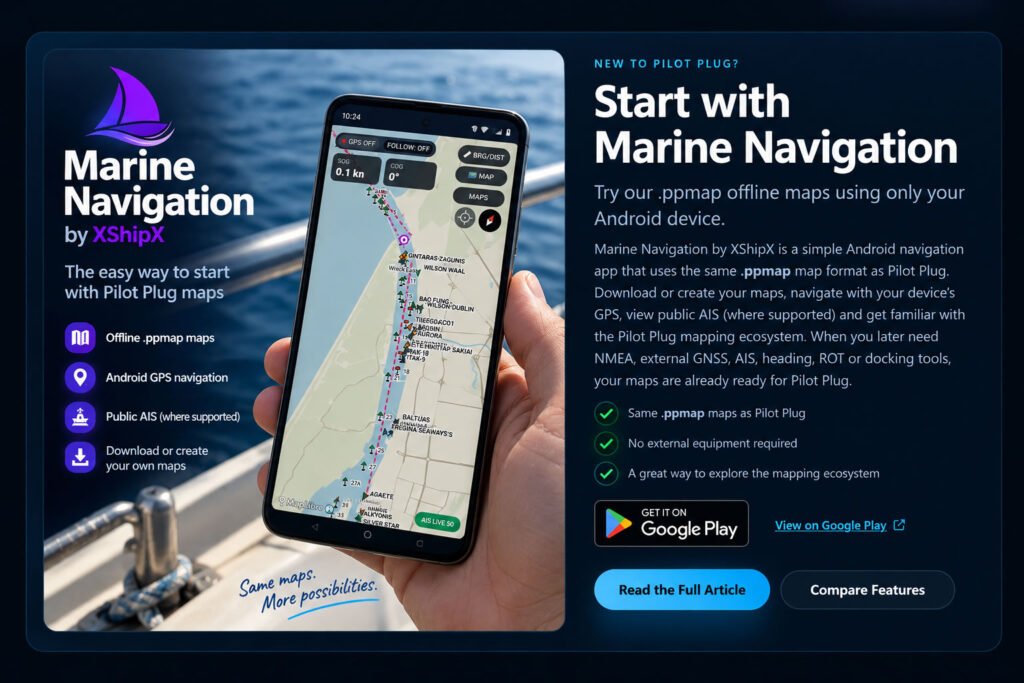
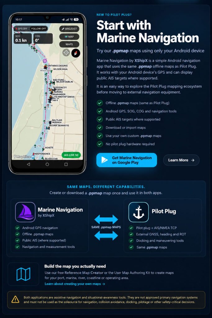
One of the most important parts of this update is that Marine Navigation now uses the same .ppmap ecosystem as the Pilot Plug app.
A map created for Marine Navigation can also be used by Pilot Plug.
A map created for Pilot Plug can be used by Marine Navigation.
There is no need to prepare two different map packages or maintain separate map formats.
This allows users to build their own local marine mapping environment once and then choose which application best suits the equipment and navigation task.
For example, a recreational or small-vessel user may use Marine Navigation with the Android device’s internal GPS.
A professional user can later open the same .ppmap map in Pilot Plug and connect external navigation equipment without rebuilding the map.
Create Your Own Marine Maps
Users are not limited to maps supplied by XShipX.
Custom .ppmap maps can be created for virtually any chosen operating area, including:
- Ports
- Marinas
- Coastal areas
- Rivers
- Harbours
- Pilot boarding areas
- Local operating zones
- Frequently used routes
- Private operational areas
The Pilot Plug Reference Map Creator and map creation instructions available through pilotplug.app can be used to build these maps.
This makes the map system flexible rather than application-specific.
A user can create a map covering exactly the area required instead of downloading an unnecessarily large region.
Public AIS Integrated Over Offline Maps
Marine Navigation can also display public AIS vessel targets in supported areas.
AIS is treated as a separate live information layer placed over the offline map.
This distinction is important.
The offline map and Android GPS navigation do not depend on AIS availability.
If the internet connection is lost, or if the public AIS source becomes unavailable, the underlying offline map remains operational and the user’s own GPS navigation continues normally.
Where public AIS coverage is available, Marine Navigation can display vessel information including, when transmitted and available:
- Vessel name
- MMSI
- Vessel dimensions
- Draught
- Destination
- ETA
- Course and speed information
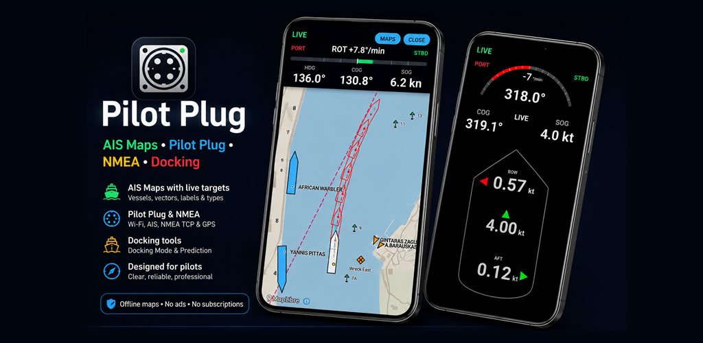
At closer zoom levels, vessels with valid AIS dimension information can also be displayed using true-scale hull geometry rather than only conventional AIS target symbols.
This provides a much clearer impression of vessel size, orientation and relative position, especially inside ports and confined waterways.
True-Scale AIS Vessel Representation
Traditional AIS displays frequently represent every vessel using essentially the same triangle or simplified symbol.
That works well for identifying targets, but it does not communicate how different a 20-metre workboat is from a 300-metre container vessel.
Marine Navigation can use transmitted AIS dimension data to reconstruct the vessel footprint at appropriate close zoom levels.
Where sufficient information is available, the map therefore shows the target with a hull corresponding approximately to the vessel’s real dimensions.
The AIS reference or antenna position is also taken into account when positioning the hull.
At wider map scales, normal compact AIS symbols remain more practical and are used instead.
The result is a display that remains clean when viewing a large area but becomes increasingly informative as the user zooms into a harbour or close-quarters environment.
Own Ship Setup
The update also introduces Own Ship Setup.
Users can enter their own vessel dimensions and the position of the Android device or GPS antenna relative to the vessel.
This is particularly useful when the GPS receiver is not located at the vessel’s geometric centre.
On a small boat the difference may be minor, but on a larger vessel the GPS reference point can be many metres away from the bow, stern or centreline.
Allowing the application to understand the vessel’s approximate geometry creates a more meaningful relationship between the displayed GPS position and the vessel itself.
Marine Navigation and Pilot Plug Serve Different Needs
Marine Navigation and Pilot Plug now share the same map ecosystem, but they are intentionally aimed at different levels of navigation equipment.
Marine Navigation is designed around straightforward navigation using the Android device’s own GPS.
It is suitable for users who primarily need an offline map, position, SOG, COG, measurement tools and supported public AIS information.
Pilot Plug is intended for users who require connections to professional external navigation data.
Depending on the installation, Pilot Plug can work with data including:
- TCP/IP NMEA
- External GPS/GNSS receivers
- Pilot plug data
- Private AIS receivers
- External heading
- Rate of Turn
- Docking and manoeuvring information
The important part is that users do not need to change their maps when moving between the two applications.
The same .ppmap file remains available.
In practical terms, a user can begin with Marine Navigation and an Android phone or tablet, create or download the maps needed for normal operation, and later use those exact maps with Pilot Plug if more advanced navigation hardware is required.
A Shared Marine Mapping Platform
The development direction behind Marine Navigation is therefore broader than adding another navigation feature.
The goal is to establish .ppmap as a common offline map format across the XShipX navigation ecosystem.
Marine Navigation provides the simpler entry point.
Pilot Plug provides the external-data and professional navigation layer.
The maps remain common to both.
This approach avoids locking users into a particular hardware configuration and allows the mapping work they create today to remain useful if their equipment changes later.
Main Features of the Updated Marine Navigation
The current Marine Navigation feature set includes:
- Offline
.ppmapmaps - Android device GPS positioning
- SOG and COG
- FOLLOW mode
- Map rotation and recentering
- Bearing and distance measurement
- Measure and TTG tools
- Public AIS targets in supported areas
- Detailed AIS target information
- True-scale AIS vessel hulls where dimensions are available
- Vessel name, MMSI, dimensions, draught, destination and ETA where available
- ONLINE MAPS catalog
- Direct
.ppmapimport - Custom user-created maps
- Own Ship Setup
- Shared
.ppmapcompatibility with Pilot Plug
Safety Notice
Marine Navigation is intended for situational awareness, reference, training and general marine navigation assistance.
It is not approved as a primary navigation system and must not be used as the sole source for navigation, collision avoidance, pilotage, docking or any other safety-critical decision.
Mariners must continue to use appropriate official charts, certified navigation equipment, radar, visual lookout and established seamanship procedures.
Marine Navigation should be regarded as an additional source of information — not a replacement for the navigation systems and professional judgement required for safe operation.
With this update, Marine Navigation by XShipX becomes the straightforward offline-navigation member of a wider XShipX ecosystem: simple Android GPS navigation when that is all that is required, public AIS where available, and full compatibility with the same .ppmap maps used by Pilot Plug when professional external navigation data is needed.