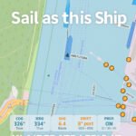
Updated: Simulation + Navigation Modes Added!
The Port of Klaipėda is one of the most active gateways to the Baltic Sea.
With KlaipėdaTraffic.lt, real-time vessel movements inside and around the port become visible to everyone: port professionals, ship enthusiasts, logistics partners, and the general public.
Unlike many global vessel tracking platforms that show delayed or aggregated positions,
KlaipėdaTraffic.lt is powered by a locally installed AIS receiver in Klaipėda.
This ensures a highly accurate, low-latency view of what is happening on the water right now.
A New Generation of Online VTS
KlaipėdaTraffic.lt is more than a standard AIS map. It can be viewed as a
virtual VTS (Vessel Traffic Service) style interface for public and professional use.
While official VTS systems remain restricted to authorities, this project offers a transparent, educational window into live traffic in the port area.
Key features include:
- Live vessel positions with frequent updates and smooth movements
- Headings, speeds, and recent trails for situational awareness
- Vessel names, types, flags, and dimensions (where available)
- Custom overlays: anchorages, fairways, quays, and restricted areas
- Locally controlled infrastructure for reliable, port-focused coverage
How Klaipėda Traffic Compares to Global AIS Platforms
Large AIS portals such as global vessel tracking websites provide worldwide coverage, but they often rely on merged data feeds and commercial aggregation. For local port operations this can mean:
- Update delays of several minutes
- Jumping or irregular vessel movements
- Coverage gaps inside smaller harbors
- Limited local context such as buoyage, port zones, and operational areas
KlaipėdaTraffic.lt is built the opposite way: from the port outward, not from the world inward.
It focuses on one port and does it with precision:
- Locally received AIS data – no third-party aggregation delays
- Rapid refresh rates for a near real-time experience
- Custom GeoJSON overlays tailored to the Port of Klaipėda
- Optimized visuals for smooth, professional-grade online monitoring
In practice, this makes KlaipėdaTraffic.lt feel much closer to a live VTS-style view than a typical public AIS map.
For users who care about actual vessel movements in and near the port, this difference is critical.
Why This Matters
The project demonstrates how a dedicated local setup can increase transparency, awareness, and engagement around maritime operations. It offers value to:
- Port authorities – supporting openness, safety culture, and outreach
- Shipping agents & terminals – fast visual confirmation of port calls and movements
- Maritime schools & universities – real-world training material for students
- Local communities & visitors – a clear, accessible way to see how the port works
Scaling the Concept: For Other Ports and Partners
KlaipėdaTraffic.lt is also a technology blueprint.
The same concept can be implemented for other ports worldwide:
- Local AIS receiver deployment and configuration
- Secure data pipeline to a dedicated server or cloud
- Custom interactive web map with port-specific overlays
- Branding, language, and feature set adapted to each port’s needs
Whether for public use, internal monitoring, or stakeholder communication,
a similar solution can transform how a port presents its daily operations online.
To discuss about this project please reach out via the contact details on
www.klaipedatraffic.lt.
Together we can bring truly live, precise, and port-focused vessel traffic visibility to more harbors around the world.
Disclaimer:
Klaipėda Traffic is a non-official, community-driven project. The information displayed is based on publicly available AIS data and is provided for general interest only. It must not be used for navigation or for any safety-critical purposes.


